

Jan. 15, 2024
Machinery
Seismic data acquisition is a crucial process in geophysics that allows scientists and researchers to explore and understand the subsurface structures of the Earth. This method involves the use of specialized equipment to record and analyze seismic waves, providing valuable insights into the composition of the Earth's interior.
Seismic data acquisition is based on the principles of seismology, the study of seismic waves generated by natural phenomena or induced artificially. These waves travel through the Earth, and by recording and analyzing their characteristics, scientists can create detailed images of the subsurface layers. This information is crucial for various applications, including oil and gas exploration, environmental monitoring, and understanding geological hazards.
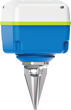
Seismic Sensors (Geophones):
Geophones are the primary sensors used in seismic data acquisition. These devices convert ground vibrations caused by seismic waves into electrical signals. Geophones are typically arranged in arrays or spread across the survey area, allowing for the collection of comprehensive data.
Recording Units (Seismic Recorders):
Seismic recorders are electronic devices that receive signals from geophones and convert them into digital data. These units are designed to store and transmit the recorded seismic information to processing centers. Modern recording units offer advanced features such as real-time data transmission and GPS synchronization for accurate location data.
Energy Sources (Seismic Sources):
Seismic sources generate the initial waves that propagate through the Earth. Common sources include air guns, explosives, and vibrators. The choice of source depends on the specific requirements of the seismic survey, such as depth of penetration and the nature of the subsurface materials.
Cables and Connectors:
To ensure seamless communication between geophones and recording units, specialized cables and connectors are employed. These components are designed to withstand harsh environmental conditions and facilitate the efficient transmission of data over long distances.
Central Recording and Processing Center:
The collected seismic data is sent to a central recording and processing center where sophisticated software is used to analyze and interpret the information. This step involves creating detailed subsurface images and identifying geological features based on the characteristics of the recorded seismic waves.
Oil and Gas Exploration:
Seismic surveys are widely used in the exploration and production of oil and gas. The data acquired helps geophysicists identify potential reservoirs and assess their characteristics.
Environmental and Engineering Studies:
Seismic data acquisition is employed for environmental studies, including assessing ground stability, monitoring land use changes, and studying the impact of human activities on geological formations.
Earthquake Research:
Understanding seismic activity is crucial for earthquake research. Seismic data helps scientists study fault lines, predict seismic events, and assess the potential impact on populated areas.
Geological Mapping:
Seismic surveys aid in creating detailed geological maps, providing insights into the structure and composition of the Earth's crust and subsurface layers.
Seismic data acquisition equipment is at the forefront of unlocking the Earth's secrets, offering a window into the depths beneath our feet. As technology continues to advance, the precision and efficiency of seismic surveys are continually improving, opening new avenues for exploration and scientific discovery. From resource exploration to environmental monitoring, the applications of seismic data acquisition are diverse and far-reaching, making it an indispensable tool in the field of geophysics.
If you are interested in sending in a Guest Blogger Submission,welcome to write for us!

All Comments ( 0 )